If you’ve heard people say “Lombok is next to Bali” but you’re not totally sure what that means on a map, this guide is for you.
You’ll learn:
- Where Lombok Island is
- What islands and seas sit around it
- Why its location is actually pretty special
- The easiest ways to reach Lombok
Where is Lombok Island? (Quick answer)
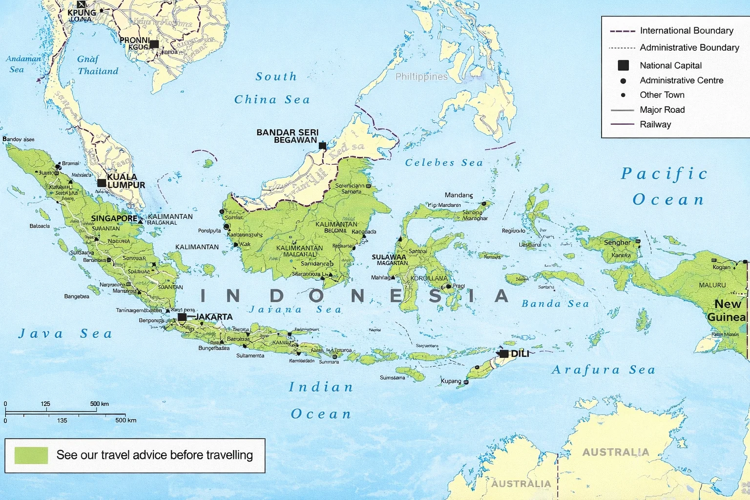
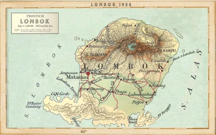
Lombok is an island in Indonesia, just east of Bali. It sits in the province of West Nusa Tenggara (Nusa Tenggara Barat / NTB).
On a map, Lombok is:
- East of Bali, separated by the Lombok Strait
- West of Sumbawa, separated by the Alas Strait
- North: the Java Sea
- South: the Indian Ocean
Lombok is also part of the Lesser Sunda Islands chain (a long line of islands running east from Bali).
Lombok’s “neighbors” (so you can picture it fast)
Think of it like this:
West → East island order
Bali → Lombok → Sumbawa → Flores → (Komodo is near Flores)
Small islands near Lombok
Lombok is also close to the famous Gili Islands (Gili Trawangan, Gili Air, Gili Meno) off the northwest coast.
What province is Lombok in?
Lombok belongs to West Nusa Tenggara (NTB) — a province made up mainly of two big islands: Lombok and Sumbawa (plus lots of smaller ones).
The provincial capital is Mataram, which is on Lombok.
Why Lombok’s location is kind of famous (the Wallace Line)
Here’s a fun “map nerd” fact that makes Lombok extra interesting:
A famous natural boundary called the Wallace Line runs through the Lombok Strait (between Bali and Lombok).
This line separates wildlife “zones” — meaning animals and nature on the Bali side are more “Asian,” and on the Lombok side you start seeing a mix that trends toward “Australasian.” It’s one reason the Bali–Lombok gap is talked about so much in nature and science travel.
How far is Lombok from Bali?
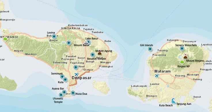
On a map, Lombok is very close to Bali. The strait between them is often described as around 35 km at its narrowest (close enough that it surprises people).
But travel time depends on how you go.
How to get to Lombok
1) Fly to Lombok (fastest)
Lombok’s main airport is Lombok International Airport (LOP) in Central Lombok.
If you’re coming from Bali (Denpasar), flights are short — often under an hour (commonly quoted around 45–50 minutes average, with shorter times also shown depending on schedule).
Good for: families, surf trips, short holidays, anyone who hates sea travel.
2) Fast boat from Bali to Lombok (common and easy)
Fast boats connect Bali ports to Lombok areas like Senggigi and sometimes onward to the Gilis.
Crossing times vary by route and sea conditions, but fast boats are often listed around:
- ~1h 15m (fastest) up to ~2 hours+ depending on the operator and stops
Good for: people combining Bali + Lombok + Gilis in one trip.
Small real-world tip: if the ocean is rough, the ride can feel long. If you get seasick easily, fly.
3) Public ferry (cheapest, slowest)
There’s also a public ferry (often used by locals, cars, and trucks). It’s cheaper, but it’s slower.
Many guides list the crossing as roughly 4–5 hours (and it can take longer with loading/unloading).
Good for: budget travelers, people bringing a motorbike/car, slower travel style.
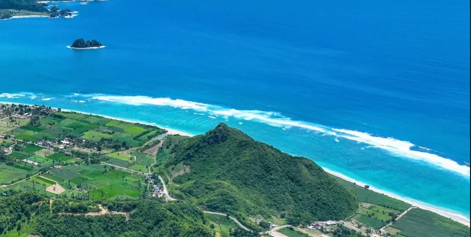
Where is “South Lombok” on the island?
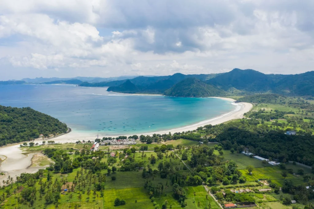
South Lombok is not a separate island — it’s the southern coastline of Lombok (facing the Indian Ocean).
It includes areas like:
- Kuta Mandalika (surf, cafés, beach clubs)
- Selong Belanak (beginner-friendly surf and family beach days) – More info here: How to Get to Selong Belanak Lombok
- Tampah / Torok / Gerupuk / Mawi (beaches, viewpoints, waves)
If you’re planning a beach lifestyle trip, South Lombok is usually where people mean.
What time zone is Lombok in?
Lombok uses WITA (Central Indonesia Time), which is UTC+8.
That’s the same time zone as Bali.
A simple way to “read” Lombok on a map (north vs south)
If you’re trying to choose where to stay, this mental map helps:
Northwest Lombok (and nearby)
- Senggigi: classic beach strip, sunsets, easier access from ports
- The Gilis: quick boat rides from the northwest side
Central / West Lombok
- Mataram: main city hub (shopping, local food, services)
North Lombok
- Mount Rinjani area: mountains, hikes, waterfalls (cooler air)
South Lombok
- Kuta & the surf bays: beaches, cafés, sunsets, surf culture
This is why “where Lombok is” matters: the island has totally different vibes depending on which side you pick.
Quick facts
- Country: Indonesia
- Province: West Nusa Tenggara (NTB)
- West of Lombok: Bali (Lombok Strait between them)
- East of Lombok: Sumbawa (Alas Strait between them)
- South: Indian Ocean
- North: Java Sea
- Airport: Lombok International Airport (LOP)
- Time zone: WITA (UTC+8)
- Fun geography fact: the Wallace Line runs through the Lombok Strait
FAQ: Where is Lombok Island?
Is Lombok part of Bali?
No. Lombok is a separate island and it’s part of West Nusa Tenggara (NTB), not Bali.
Is Lombok close to Bali?
Yes. Lombok is right next to Bali on the map, separated by the Lombok Strait.
What’s between Bali and Lombok?
The Lombok Strait — it’s also where the famous Wallace Line passes.
What is the main airport in Lombok?
Lombok International Airport (LOP) in Central Lombok.
What time zone is Lombok in?
WITA (UTC+8).
What’s the easiest way to reach Lombok?
For most travelers: fly to LOP (quick and smooth) or take a fast boat if you’re combining Bali + Lombok + Gilis.
Final Thoughts
Lombok is close to Bali — but it’s not Bali.
It’s a separate island, in a different province, with a different feel. On the map, it’s simple: Bali → Lombok → Sumbawa. But knowing that helps you plan better — where to stay, how to get there, and what kind of trip you actually want.
Fly if you want it fast and easy.
Take a boat if you’re combining islands.
Pick north or south depending on your vibe.
Once you see Lombok clearly on the map, the rest of the decisions get much simpler.